Levada dos Piornais
Trail details
My trails
What to Expect
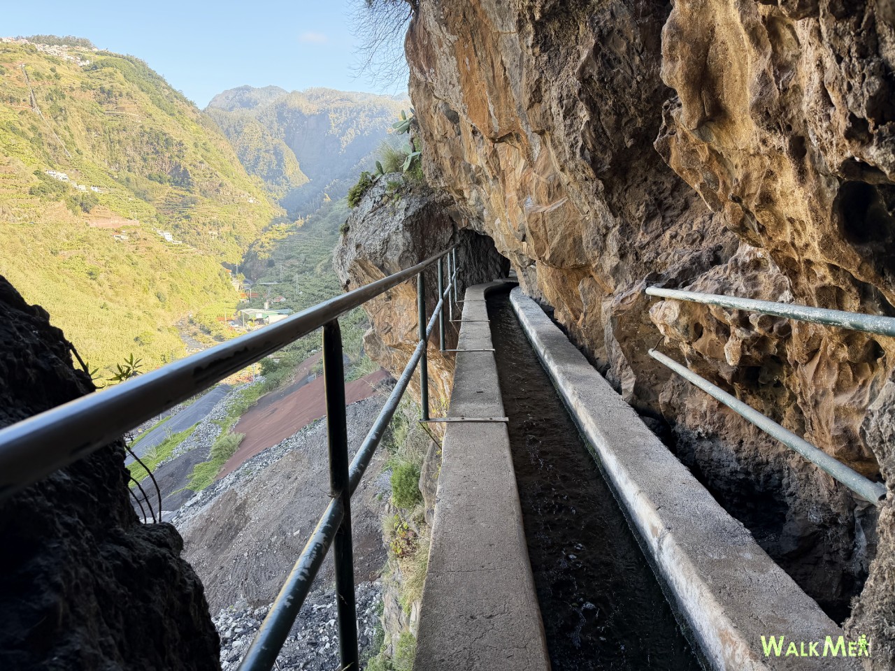
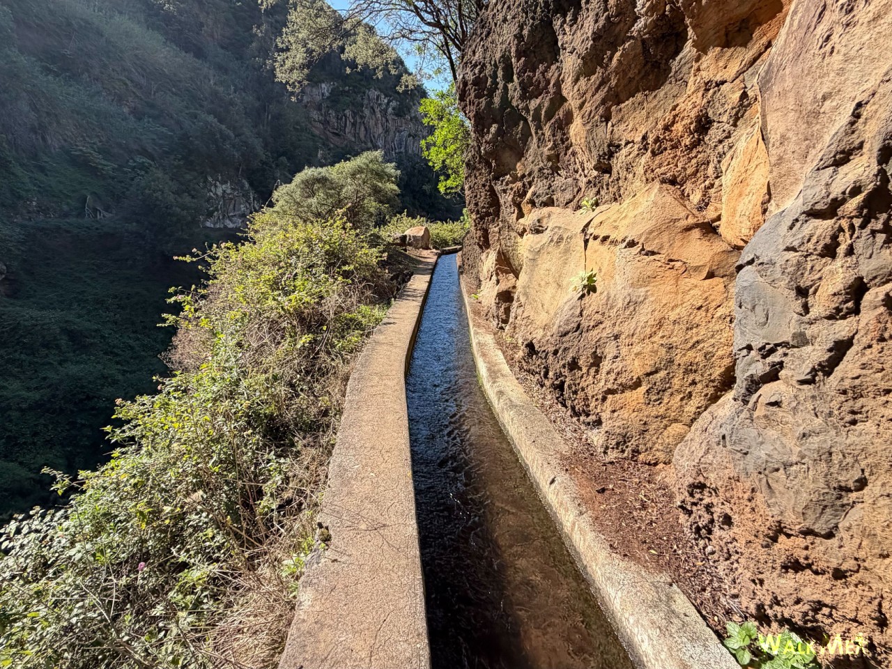
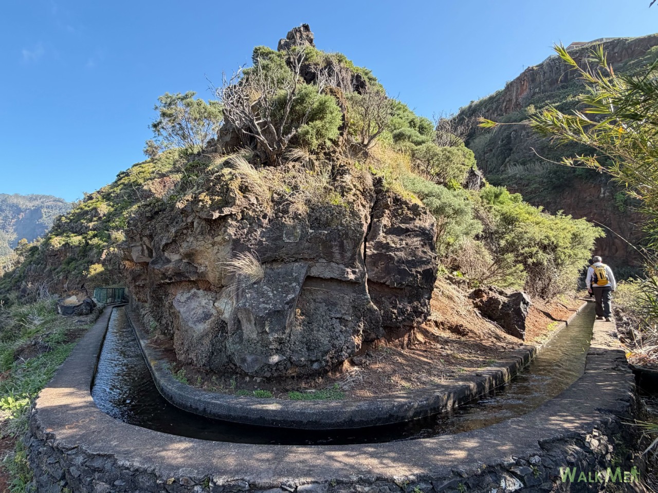
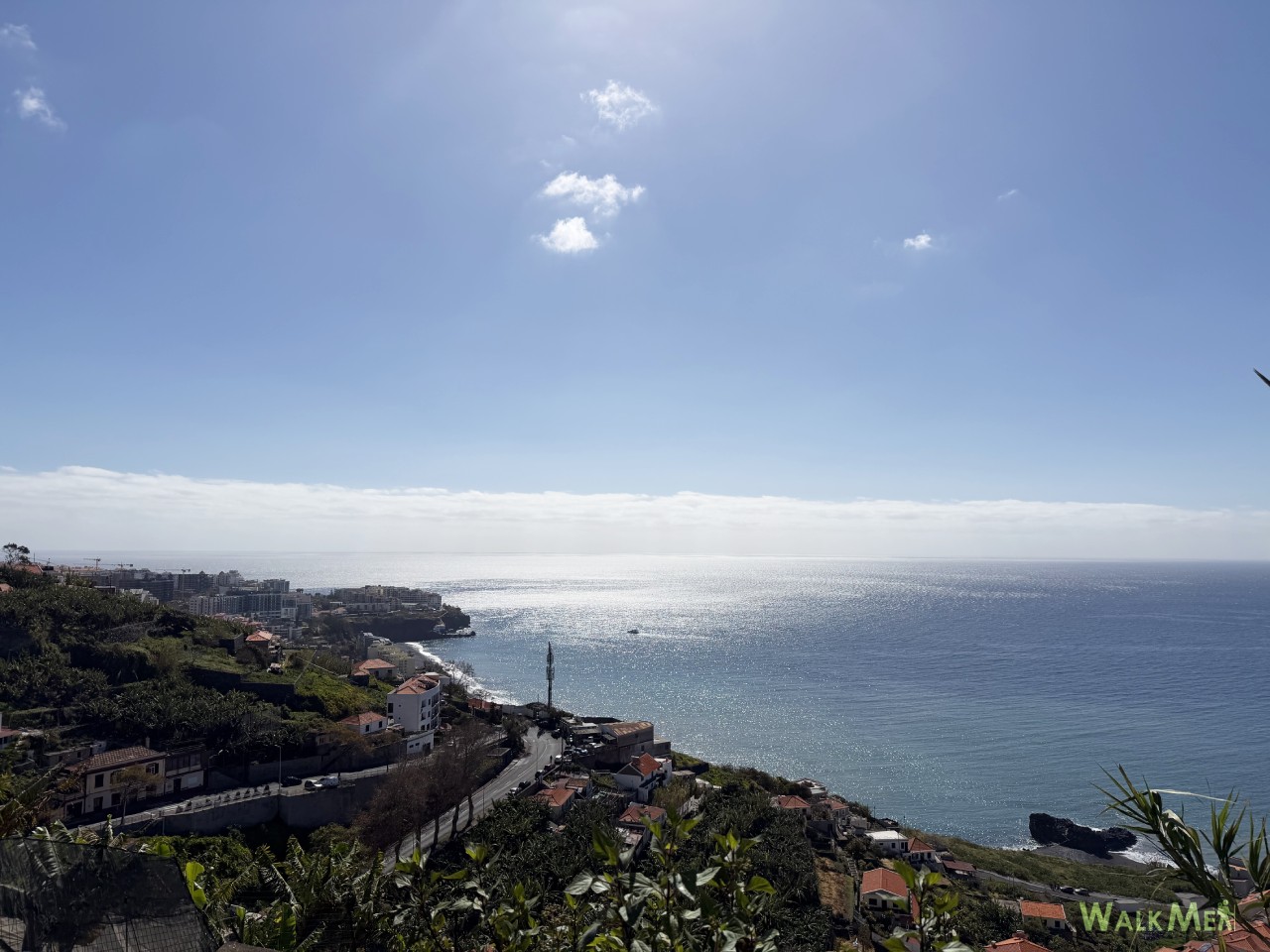
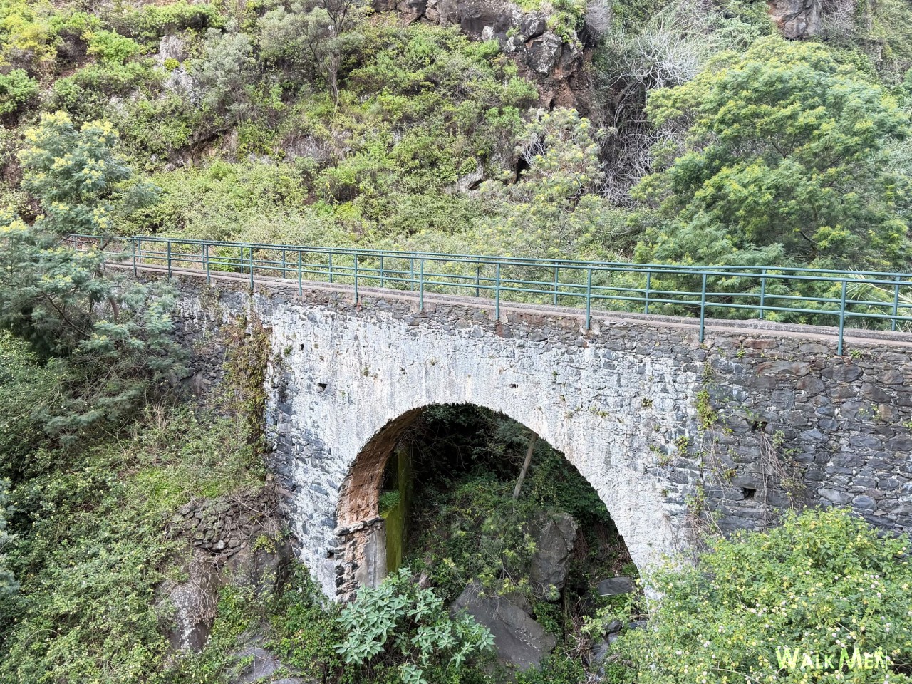
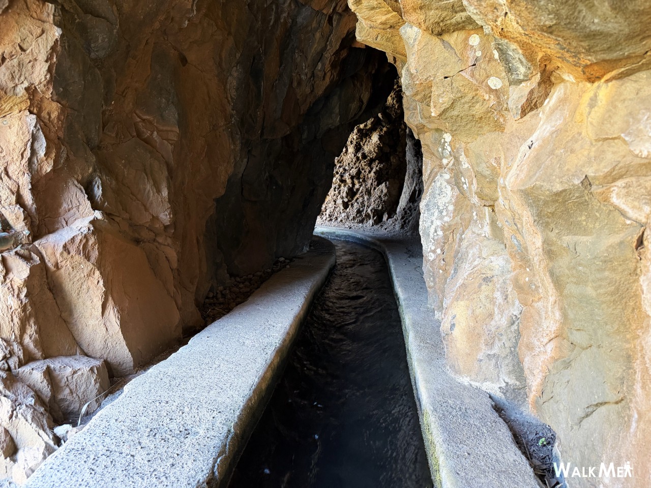
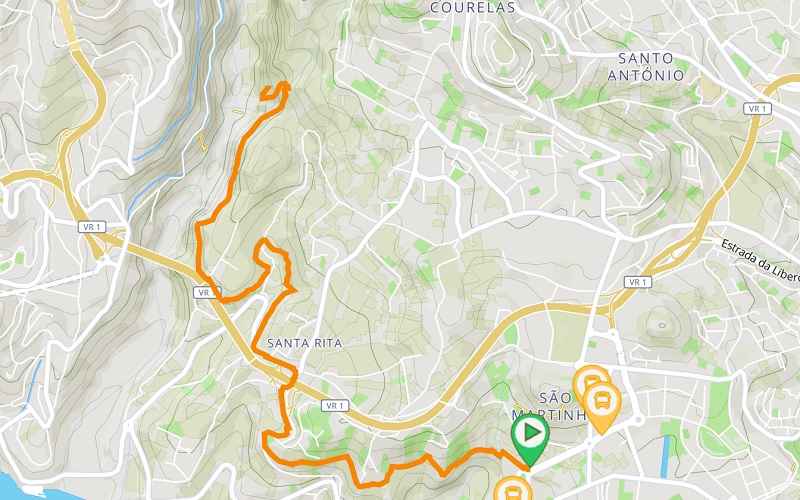
The Levada dos Piornais invites walkers to discover one of Madeira’s most urban levadas, where nature and city blend in perfect harmony. Located between Funchal and Câmara de Lobos, this route connects São Martinho to the Ribeira dos Socorridos Valley, offering diverse and surrounding landscapes that include sea views, agricultural fields, mountain scenery, and urban areas. Along the way, you can feel the contrast between the peaceful flow of water in the levada and the dynamic atmosphere of the residential areas that have grown around it. With around five centuries of existence, Levada dos Piornais has witnessed countless transformations, remaining an important historical and cultural element of Madeira’s landscape. The route includes some rock-carved tunnels that are relatively low and require extra attention, as well as narrow sections without protection and close to steep drops. For this reason, caution is advised, especially in more exposed areas. The trail continues beyond the bridge at Ribeira dos Socorridos Valley, but the path becomes narrower and more exposed, so we recommend finishing the walk near the bridge. Due to its proximity to Funchal, this levada is an excellent option for those who wish to experience a typical Madeira levada walk without venturing far from the city centre. Come and explore this unique trail and discover a different perspective of the island.
Gallery
Map and Elevation profile

Trail Overview
Public transport
2
4
45

Trail details
My trails
Weather
Webcam
www.netmadeira.ptMore trail details in WalkMe APP

Comments (0)
To leave a comment you must be
Hike this trail with confidence.